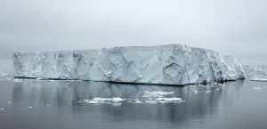
Detailed satellite scans of a key glacier in West Antarctica have renewed warnings that a combination of meltwater and seawater flowing deep underneath the ice is causing “vigorous melting” at the base of the Thwaites Glacier—nicknamed the ‘Doomsday Glacier’ because of its potential to raise sea levels by ten feet if it were to fail entirely—at a new rate of melt that may require a reassessment of global sea level rise forecasts.
Using high-resolution radar data gathered by Finland’s ICEYE satellite constellation, glaciologists at the University of California, Irvine found evidence of warm, high-pressure seawater flowing into the gap between the bottom of the Thwaites Glacier and the seabed, with the glacier rising, falling and flexing in time with the local tides.
“These ICEYE data provided a long-time series of daily observations closely conforming to tidal cycles,” explained lead study author Eric Rignot, professor of Earth system science at UC Irvine.
“In the past, we had some sporadically available data, and with just those few observations it was hard to figure out what was happening,” Rignot continued. “When we have a continuous time series and compare that with the tidal cycle, we see the seawater coming in at high tide and receding and sometimes going farther up underneath the glacier and getting trapped. Thanks to ICEYE, we’re beginning to witness this tidal dynamic for the first time.”
The effect being observed is due to a confluence of two major factors: from outside, seawater seeps in underneath the ice where the glacier meets the sea; additionally, heat built up from a combination of geothermal flux and friction from the glacier’s downhill flow adds a layer of melted freshwater to the mix; according to Rignot the buildup of water from both directions “has to flow somewhere,” leading to the glacier being elevated by the collective pressure of the pooled water.
“There are places where the water is almost at the pressure of the overlying ice, so just a little more pressure is needed to push up the ice,” Rignot said. “The water is then squeezed enough to jack up a column of more than half a mile of ice.”
Adding to the problem is that the highly-saline seawater coming from the depths of the Southern Ocean freezes at a point roughly two degrees Celsius (3.6°F) colder than fresh water, enabling the fluid to continue to flow in conditions that would typically turn water into solid ice.
In a broader context, Thwaites is a key component in the system of glaciers that flow across West Antarctica: although Thwaites itself holds enough ice to raise sea levels by an estimated 60 centimeters (24 inches) if it were to melt entirely, the glacier also acts a plug for the other ice flows that surround it, and if it were to fail it could trigger a cascading collapse of ice into the ocean that would result in a 3.3-meter (10-foot) increase in sea levels—hence Thwaites’ foreboding nickname of “The Doomsday Glacier’.
“If we put this type of ocean-ice interaction into ice sheet models, I expect we will be able to do a much better job of reproducing what has happened in the past quarter century, which will lead to a higher level of confidence in our projections,” Rignot explained, referring to potential improvements to ice melt and sea level rise forecasting.
“If we put this type of ocean-ice interaction into ice sheet models, I expect we will be able to do a much better job of reproducing what has happened in the past quarter century, which will lead to a higher level of confidence in our projections,” Rignot added. “If we could add this process we outlined in the paper, which is not included in most current models, the model reconstructions should match observations much better. It would be a big win if we could achieve that.”
Subscribers, to watch the subscriber version of the video, first log in then click on Dreamland Subscriber-Only Video Podcast link.
10 feet is a lot