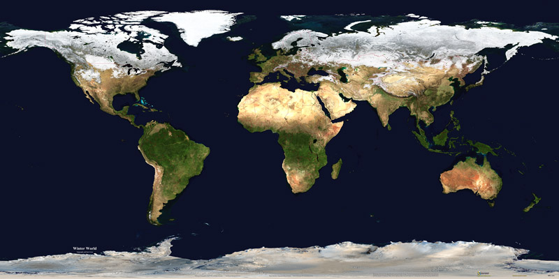
A recent analysis of historical snow data gathered by NOAA satellites has found that previous surveys overestimated the decadal growth of the planet’s snow cover by a substantial amount—indeed, while the data was showing an increase in snow cover decade-over-decade, the seasonal snowpack was actually shrinking—meaning the Earth’s surface is less capable of reflecting energy from the Sun back into space than previously assumed.
The National Oceanic and Atmospheric Administration has been gathering satellite data on the Northern Hemisphere’s autumn snow cover since the 1960s, a key metric in evaluating how much solar energy is being reflected back into space, as opposed to being absorbed by the planet’s surface and converted into heat energy.
Due to the higher albedo, or reflectivity, provided by ice and snow than that of uncovered land, with ice reflecting about 80 percent of the sunlight that strikes it, compared to less than half being bounced back into space by bare surface or vegetation, this metric has been a component of global warming forecasts. And up until now NOAA’s satellite-based data had been showing snow growth of roughly a million and a half square kilometers (579,000 square miles) per decade, a measurement that didn’t match what was being recorded on the ground.
Curious about the discrepancy, a team with the Faculty of Arts & Science at Canada’s University of Toronto looked into the matter and found that the snow cover was instead shrinking by half a million square kilometers (19,300 square miles) per decade.
“Snow cover is important because it’s a positive climate feedback mechanism,” according to study lead Aleksandra Elias Chereque, a PhD candidate with U of T’s Faculty of Arts & Science physics department.
“This is referred to as the snow-albedo effect—albedo meaning reflectivity,” Elias Chereque continued. “Snow loss leads to a decrease in albedo, which leads to higher energy absorption, which, in turn, leads to enhanced snow loss. This is a contributing factor to a phenomenon known as ‘Arctic amplification,’ and it’s why we observe a disproportionate amount of heating in the Arctic.”
Ironically, the discrepancy arose from improvements in the instrumentation being made to NOAA’s satellites over the years, allowing them to gather data with increasingly improved resolution: the resulting increase in sensitivity to areas with thinner snow cover that might have been overlooked by older satellites was now being factored into the surveys, making it appear as if there was more effective snow cover than before, despite the actual shrinkage being experienced.
“It’s as if the satellite’s ‘eyeglasses’ got better and better over that period,” explained Elias Chereque. “It looks like there’s more snow now than there used to be—but that’s only because the satellite kept getting better ‘prescriptions’ for its glasses. It looked like there was more snow, but that’s not what was happening.”
This discovery means that previous climate models were factoring in much more snow cover than there actually was, meaning global warming forecasts were likely more optimistic than what the future might actually have in store.
“We know snow loss is influenced by anthropogenic warming and snow loss also creates more potential for warming through the snow-albedo feedback, so we’ve gained a better understanding of this important mechanism of Arctic amplification,” Elias Chereque added.
“Showing how and why the snow cover trend was wrong helps us learn how to use this data set properly when we’re estimating past conditions and future trends. And that helps in understanding whether climate models are accurate.
“Developing tools like this help us better understand the climate and make better predictions about the future.”