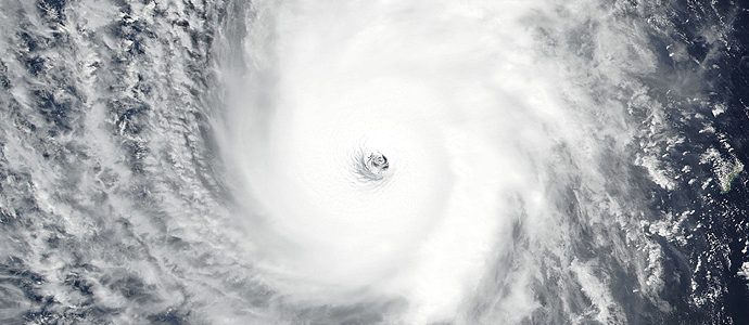
Hurricane Michael made landfall in the Florida Panhandle earlier today, but it did so as a category-4 hurricane with wind speeds of up to 150 mph (240 kph), rather than the category-3 that it was originally forecast to be. This is the strongest storm to hit the Panhandle on record, fueled by unusually warm 84ºF (29ºC) water temperatures. The storm is projected to track northeast over Georgia and the Carolinas, a circumstance that might exacerbate an already disastrous situation if Michael adds rain to the areas already affected by flooding from Hurricane Florence. More than 370,000 people along the Gulf coast have been ordered to evacuate, but authorities are concerned that many did not heed the warning.
read more

Back in 1985 when I published Nature’s End, my publisher arranged a news conference in Washington. The environmental reporters who showed up mostly scoffed at the warnings in the book. It predicted terrible fires, catastrophic droughts and pollution emergencies among other things, set in the context of a science fiction story. It was set in the year 2020. My co-author James Kunetka and I had called it with heartbreaking accuracy. We were ignored.
read more

Hurricane Michael, currently a catergory-1 storm, is tracking northward across the Caribbean, and is expected to make landfall in Florida on Wednesday. The storm is currently over Cuba, and is expected to strike the Florida Panhandle as a category-3 hurricane, with wind speeds up to 129 mph. Due to the high warmth of Gulf of Mexico waters, the storm could strengthen dramatically and suddenly as it moves off Cuba and out into the Gulf. This is what caused Hurricane Katrina to become such a severe storm as it moved onshore over New Orleans in 2005.
read more